 |
 |
 |
Cumberland Gap
on Merlyn St near the corner of Colwyn St in Cumberland Gap, Cumberland Gap,
TN ,
USA
Latitude & Longitude:
36° 35' 56.999976",
-83° 39' 58.979988"
|
|

Tennessee State
Historical Marker

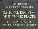
Listed in the National Register of Historic Places |
| |
| |
First explored, 1750; Long Hunters used it until 1760, and Daniel Boone in 1769, cutting the Wilderness Trail through it in 1775. Hosts of pioneers followed even before the road was built in 1796. Postal service was established in 1795 and a post office in 1803. The Gap changed hands 4 times during War Between the States.
Tennessee Historical Commission
Last updated: 2/14/2015 15:17:00 |
|
|
| |
|
|
| |
|
|
Cumberland Gap Tennessee Map
|
|
|


