 |
 |
 |
Wartrace
Blackman Boulevard (U.S. 64), Wartrace,
TN ,
USA
Latitude & Longitude:
35° 31' 31.559988",
-86° 20' 2.4"
|
|

Tennessee State
Historical Marker

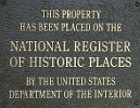
Listed in the National Register of Historic Places |
| |
| |
In 1850, Rice Coffey gave eight acres to the Nashville and Chattanooga Railroad on which the main line would run with a depot and freight house at the junction of the branch line to Shelbyville. In 1851, town lots were laid off. The following year, a post office was established. In 1853, the town was incorporated as Wartrace Depot after Wartrace Creek. Twenty years later, the name was changed to Wartrace after Wartrace Creek, which was named for the War Trace, a buffalo path used by Indians at war with Nashville settlers in the 1790's.
Erected by Tennessee Historical Commission.
Last updated: 2/14/2015 15:17:00 |
|
|
| |
|
|
| |
|
|
Wartrace Tennessee Map
|
|
|


