| |
|
|
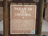
Paraje De Fra Cristobal
I-25, Socorro,
NM,
USA
Latitude & Longitude:
33° 37' 17.9112",
-107° 8' 18.2148"
|
|

New Mexico State
Historical Marker
|
| |
| |
| |
|
|
The mountain range seen along the east bank of the Rio Grande is named after Father Cristobal de Slazar of the 1598 Juan de Oñate expedition. An encampment at the northern edge of the mountain, whose profile is said to resemble that of the good friar, was a place of rest for caravans on the Camino Real.
Last updated: 12/22/2009 10:38:45 |
|
|
|
| |
|
|
Image Gallery
|
|
|
Paraje De Fra Cristobal Historical Marker Location Map, Socorro, New Mexico
|
|
|