| |
|
|
Santa Clara Pueblo
S of Espanola off NM 30, Espanola,
NM,
USA
Latitude & Longitude:
35° 58' 6.005172",
-106° 5' 20.30568"
|
|

New Mexico State
Historical Marker
 |
| |
| |
| |
|
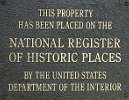
Listed in the National Register of Historic Places |
Founded around the fourteenth century, Santa Clar traces its ancestry to Puyé, an abandoned site of cave dwellings on the Pajarito Plateau. Increasing tensions with the Spanish led to the participation in the Pueblo Revolt of 1680. The mission church is thought to be the narrowest of its kind.
Santa Clara Pueblo was listed in the National Register of Historic Places on November 05, 1974.
Last updated: 10/12/2009 15:10:00 |
|
|
|
| |
|
|
| |
|
|
Santa Clara Pueblo Historical Marker Location Map, Espanola, New Mexico
|
|
|


