| |
|
|
Magnolia Lane
2141 River Rd., Westwego,
LA,
USA
Telephone:
(504) 436-4915
Latitude & Longitude:
29° 57' 3.4794",
-90° 9' 10.65096"
|
|

Louisiana State
Historical Marker

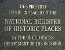
Listed in the National Register of Historic Places |
| |
| |
| |
|
|
Area known as Nine Mile Point; site of Fortier Plantation and one of the area's first schools, churches and later site of WWI commissary. Once the home of Fran‡ois Quinet, Sr., statesman & developer of early New Orleans; Nearby was site of Fort Banks which blockaded River during Civil War.
Last updated: 7/27/2009 15:10:00
| StoppingPoints.com Editorial on Magnolia Lane: | | Magnolia Lane Plantation House |
|
|
|
Related Themes: C.S.A., Confederate States of America, Confederacy
Explore other
Louisiana Civil War Historical Markers.
|
| |
|
|
| |
|
|
Magnolia Lane Historical Marker Location Map, Westwego, Louisiana
|
|
|


