| |
|
|
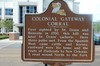
Colonial Gateway Corral
Natchitoches,
LA,
USA
Latitude & Longitude:
31° 43' 30.9684",
-93° 5' 53.394"
|
|

Louisiana State
Historical Marker |
| |
| |
| |
|
|
First sighted by St. Denis and Bienville in 1700, this hill was later St. Denis' vacherie. Here three paths met. From the Spanish west came cattle and horses; eastward were his home and the route of flatboats to New Orleans. A road wound north to the Fort.
Last updated: 4/10/2016 14:53:52 |
|
|
|
| |
|
|
Image Gallery
|
|
|
Colonial Gateway Corral Historical Marker Location Map, Natchitoches, Louisiana
|
|
|