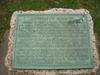
Settled by people from Tennessee under and 1922 contract held by Sterling Clark Robertson (1785-1842), who later signed the Texas Declaration of Independence. Colony and county were named for him. County was created Dec. 14, 1837; organized March 1838. County seats: Old Franklin, 1838-1850; Wheelock, 1850-1855; Owensville, 1855-1869; Calvert, 1870-1879; Franklin since 1879. Sent 5 troop companies into Confederate service in Civil War. Established mill to make flour, cotton and wool cloth. Furnished cotton cards, medicines, flour, bacon and salt to soldiers' families.
This page last updated: 7/15/2008 |
Image Gallery
Robertson County Historical Marker Location Map, Texas
|
|
Related Themes: Texas C.S.A., Texas Confederate States of America, Confederacy
Explore other
Texas Confederate Historical Markers.
|