| |
|
|
Martin Allen |
|
 |
|
Wallis vicinity,
TX,
USA
Latitude & Longitude:
29° 40' 4.998",
-96° 6' 52.0992"
|
| |
| |
|
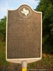
Texas State
Historical Marker |
(November 28, 1780-December 30, 1837) As a young man Martin Allen assisted his father, Benjamin, in surveying roads in their native state of Kentucky. He married Elizabeth Vice in 1804 and by 1810 they and their three children were living in Louisiana. Martin joined the Gutierrez-Magee Expedition's bid to rid Texas of Spanish rule in 1812-1813. His father and nephew were killed at the decisive Battle of Medina. Martin, on a recruiting mission at the time, survived. After a brief stay in Arkansas territory, the Allens moved back to northwest Louisiana about 1818 and settled in a community which shortly thereafter was named Allen's Settlement in Martin's honor. In 1821 Martin traveled to nearby Wharton County as one of Stephen F. Austin's Old Three Hundred colonists and was among the first settlers on the Colorado River. About 1834 the Allens purchased land here at Eight Mile Point (so named for its distance from San Felipe de Austin) from their son, Miles N. The Allens lived on this property for the rest of their lives. Allen family members operated a Public House about 1/4 mile east of here that was frequently visited by future hero of the Alamo, William B. Travis. Martin, a Texas War for Independence veteran, was buried near the Public House in the Allen family cemetery. (1993)
This page last updated: 6/1/2010 14:16:51 |
Image Gallery
Martin Allen Historical Marker Location Map, Wallis vicinity, Texas
|
|
|
|