| |
|
|
Early Roads to San Felipe |
|
 |
|
San Felipe,
TX,
USA
Latitude & Longitude:
29° 48' 22.7988",
-96° 5' 51.7992"
|
| |
| |
|
Texas State
Historical Marker |
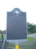
During the mid-1820s, when Stephen F. Austin was founding this town, the only roads in the area were wagon ruts of beaten trails marked by notched trees. Within a decade, however, the village of San Felipe, one of the first Anglo settlements in Texas, had become a hub from which 8 or more roads projected. Many of these were small, intra-colony routes, but the main trails extended to major towns or joined highways, such as the San Antonio Road (El Camino Real). A main route which passed through San Felipe was the Atascosita Road, connecting Goliad with the United States. It took its name from Atascosa (Spanish for boggy) Spring near Liberty, which once was its main terminus. The Gotier Trace, another travel artery, was laid out about 1830 by pioneer James Gotier. It joined the northern and southern parts of Austin's colony and was used for decades. The San Felipe Road proper, which ran to Harrisburg, transported goods inland from the Gulf Coast. Even the main thoroughfares, however, were dusty trails in the summer and impassable quagmires in the winter, often flooded by knee-deep water. Not until well into the 20th century did Texas begin to develp her present, outstanding highway system. (1969)
This page last updated: 6/1/2010 14:12:38 |
Image Gallery
Early Roads to San Felipe Historical Marker Location Map, Texas
|
|
|
|