 |
 |
 |
Fort Granger
405 Murfreesboro Road, Franklin,
TN ,
USA
Latitude & Longitude:
35° 55' 19.2",
-86° 51' 44.579988"
|
|

Tennessee State
Historical Marker

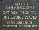
Listed in the National Register of Historic Places |
| |
| |
In the spring of 1863, Federal forces commanded by Maj. Gen. Gordon Granger occupied Franklin. Construction of major fortifications began under the direction of Capt. W. E. Merrill, U.S. Corps of Engineers, the largest of them being placed on Figuers Bluff, .2 of a mile north on the Harpeth River. Fort Granger commanded the southern and northern approaches to Franklin and was adjacent to the critically important Tenn. & Ala. Railroad bridge. The artillery within the fort saw action twice in 1863 against Confederate cavalry forces. During the Battle of Franklin. Nov. 30, 1864 the site served as Hqtrs. of Maj. Gen. John M. Schofield (commander of U.S. forces) and as an active artillery position.
Erected 1989 by Williamson County Historical Society.
Last updated: 2/14/2015 15:17:00 |
|
|
| |
|
Related Themes: C.S.A., Confederate States of America, Confederacy, Union States
Explore other
Tennessee Civil War Historical Markers.
|
| |
|
|
Fort Granger Historical Marker Location Map, Franklin, Tennessee Map
|
|
|


