 |
 |
 |
Dungan's Mill
at the intersection of Elizabethton Highway (Tennessee Route 91) and Smalling Road, Johnson City,
TN ,
USA
Latitude & Longitude:
36° 19' 35.999976",
-82° 17' 56.279976"
|
|

Tennessee State
Historical Marker

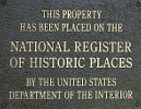
Listed in the National Register of Historic Places |
| |
| |
6.5 miles northwest, at the mouth of Brush Creek, is a mill built by Jeremiah Dungan in 1779, and continuously operated since then. East of it was a stone fort erected by pioneers of the Watauga Settlement.
Dungan and other pioneers are buried in the vicinity.
Erected by Tennessee Historical Commission.
Dungan's Mill was listed in the National Register of Historic Places on July 02, 1973.
Last updated: 2/14/2015 15:17:00 |
|
|
| |
|
|
| |
|
|
Dungan's Mill Historical Marker Location Map, Johnson City, Tennessee Map
|
|
|


