 |
 |
 |
City of Edgefield
Roughly bounded by Woodland, S. 10th and S. 5th Sts., and Shelby Ave. , Nashville,
TN ,
USA
Latitude & Longitude:
36° 10' 21.855324",
-86° 45' 27.925956"
|
|

Tennessee State
Historical Marker

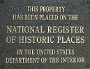
Listed in the National Register of Historic Places |
| |
| |
The portion of East Nashville known as Edgefield, the name suggested by Gov. Neill S. Brown, was incorporated as a city Jan. 2, 1869. Its approximate bounds were Shelby Ave., Sevier St., So. 10th St., Berry St., Cowan Ave. and the River. It’s first mayor was W.A. Glenn and its last was S.M. Wene. It was annexed to the City of Nashville Feb. 6, 1880.
Corrections: An ‘L’ has been deleted from Neill S Brown.
The first initial of Mr. Wene, Edgefield’s last mayor, is incorrect. His first initial should be S rather than W. Also, the Nashville city directory for 1878 lists S.M. Wene followed by the title “Mayor of Edgefield.”
Location: E side of Woodland St. Bridge
City of Edgefield was listed in the National Register of Historic Places on July 13, 1977.
Last updated: 2/14/2015 15:17:00 |
|
|
| |
|
|
| |
|
|
City of Edgefield Historical Marker Location Map, Nashville, Tennessee Map
|
|
|


