Historical Markers StoppingPoints.com Historical Markers, Sightseeing & Points of Interest Scenic Roads & Points of Interest
About Us | Photo Gallery | Free Widgets | Featured States | Search Site
Register or Edit LoginRegister
Home New York Albany County Colonie Historical Markers Watervliet Shaker Historic District (Boundary Increase)
     

Watervliet Shaker Historic District (Boundary Increase)

Stump Pond, NE of Colonie, Colonie, NY, USA

Latitude & Longitude: 42° 44' 21.897132", -73° 49' 14.14272"
  National Register of Historic Places
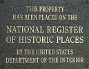
Listed in the National Register of Historic Places


Watervliet Shaker Historic District (Boundary Increase) was listed in the National Register of Historic Places on September 20, 1973.

Last updated: 10/25/2010 15:10:00


Watervliet Shaker Historic District (Boundary Increase) Historical Marker Location Map, Colonie, New York