| |
|
|
Fort Stanton
7 mi. SE of Capitan near U.S. 380, Capitan,
NM,
USA
Latitude & Longitude:
33° 29' 40.25436",
-105° 31' 36.01956"
|
|

New Mexico State
Historical Marker
 |
| |
| |
| |
|
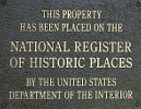
Listed in the National Register of Historic Places |
Fort Stanton, 1855-1896, named for Captian Henry Stanton, was established to control the Mescalero Apaches. Burned and evacuated by Union troops in 1861, held briefly by the Confederates, and then reoccupied by Colonel Kit Carson for the Union in 1862. Abandoned as a military post, it was used as a hospital.
Fort Stanton was listed in the National Register of Historic Places on April 13, 1973.
Last updated: 10/12/2009 15:10:00 |
|
|
Related Themes: C.S.A., Confederate States of America, Confederacy
Explore other
New Mexico Civil War Historical Markers.
|
| |
|
|
| |
|
|
Fort Stanton Historical Marker Location Map, Capitan, New Mexico
|
|
|


