| |
|
|
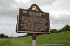
The Settlement Of Freetown
River Road, St. James,
LA,
USA
Latitude & Longitude:
30° 2' 37.3452",
-90° 50' 46.212"
|
|

Louisiana State
Historical Marker |
| |
| |
| |
|
|
Following the Civil War, thirty-one individuals bought lots from C. Oliver, who acquired portions of land that was formerly a part of the Pedesclaux-Landry Plantation in St. James, LA. Together, the group carved out and cultivated the land and established the parish?s first multi-ethnic settlement of property owners. Master carpenter Elfere Mitchell built Freetown Hall in the early 1900s.
The pioneering settlers and landowners were: J.C. Oliver, Celstin Oliver, Jean-Baptiste Louis, Onzim Louis, John Le¢n Louis, Jean Louis Jr., Joachim Paul, Victorin Moris, Narcisse Gibson, dmond Johnson, Flix Moris, Ben Benjamin, Ursin Toussaint, Philipp Simms, Lindor Louis, Aaron llison, Sally Johnson, Mack Nelson, William Jackson, Alec Smith, Trazimon Communi, James Clay, Jean-Baptiste Phillipp, Josph Scott, Constantin Boyd, Victor Jacob, Moses Lane, Paul Daniel, Thoville Pierre, Louis Josph, and Samuel Brown.
Last updated: 4/9/2016 15:57:13 |
|
|
Related Themes: C.S.A., Confederate States of America, Confederacy
Explore other
Louisiana Civil War Historical Markers.
|
| |
|
|
Image Gallery
|
|
|
The Settlement Of Freetown Historical Marker Location Map, St. James, Louisiana
|
|
|