(within area encompassed by)
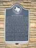
A reservation of land made under an Empresario contract by the Republic of Texas, 1841. Its purpose was to introduce colonists into this area. Under the first of four contracts, W. S. Peters and 19 partners agreed to introduce 600 families in three years, to furnish each with seed, shot, and a cabin, and also to survey the land. Each family was to receive 640 acres of land free and each single man, 320 acres. Of this, the company could take half for its services.
Three later contracts altered terms somewhat, and although the land company underwent several internal upheavals, by 1848 there were approximately 1,800 colonists and their families in the area. Resentment over the company's share of land climaxed in 1852 when settlers drove out the unpopular agent, Henry O. Hedgcoxe, in the so-called Hedgcoxe War.
Because of its success in opening a large area of the frontier and its later effect on Texas land and immigration policy, the law establishing this colony was one of the most important in the Republic.
In spite of unusual tumult and hardship, the final Peters Colony area today extends over five counties and encompasses one-fourth of the state's population, including its largest combined metropolitan area. (1970)
This page last updated: 7/15/2008 |
Image Gallery
Peters Colony Historical Marker Location Map, Lewisville, Texas
|
|
Related Themes:
Peters Colony
|