 |
|
|
San Buenaventura Mission Aqueduct
234 Canada Larga Rd, Ventura,
CA ,
USA
Latitude & Longitude:
34° 20' 30.894",
-119° 17' 17.5848"
|
|

California State
Historical Marker
|
| |
| |
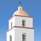
The aqueduct at Canada Larga Road is two surviving sections of viaduct about 100 feet long and made of cobble stone and mortar. Originally, the watercourse ran from a point on the Ventura River about 1/2 mile north of the remaining ruins and carried the water to holding tanks behind the San Buenaventura Mission, a total of about 7 miles. The aqueduct was built by Chumash Indians 1805-15 to meet the needs of the mission population and consisted of both ditches and elevated stone masonry. The entire water system was destroyed by floods and abandoned in 1862.
Last updated: 2/15/2016 21:05:00 |
|
|
| |
|
Related Themes: Early Spanish Missions in the New World
See more historic sites related to Spanish Missions.
|
| |
|
|
San Buenaventura Mission Aqueduct California Map
|
|

